
Volcanoes can reshape entire landscapes, bury settlements, and disrupt everyday life.
Volcanic hazards have not prevented millions of people from building their lives in regions surrounding active volcanoes.
Some communities have occupied these areas for generations, while others have grown around fertile farmland, established towns, and important economic centers.
Living near a volcano involves more than accepting the possibility of an eruption.
The same geological forces that create volcanic hazards can also provide fertile land, mineral resources, geothermal power, and tourism opportunities.
These benefits help explain why people continue to settle in areas that also carry significant natural hazards.
However, the risks are real.
Depending on the volcano, nearby communities may face lava flows, falling volcanic ash, pyroclastic flows, lahars, earthquakes, and volcanic gases.
Even places that experience long periods of quiet can face sudden changes in activity.
The relationship between people and their surroundings is also evident in communities that have adapted to difficult climates, as explored in 10 Places Around the World Where People Have Adapted to Extreme Weather.
These 10 places show how communities live alongside active volcanoes, balancing the resources they provide with the hazards they pose.
1. Mayon Volcano, Philippines
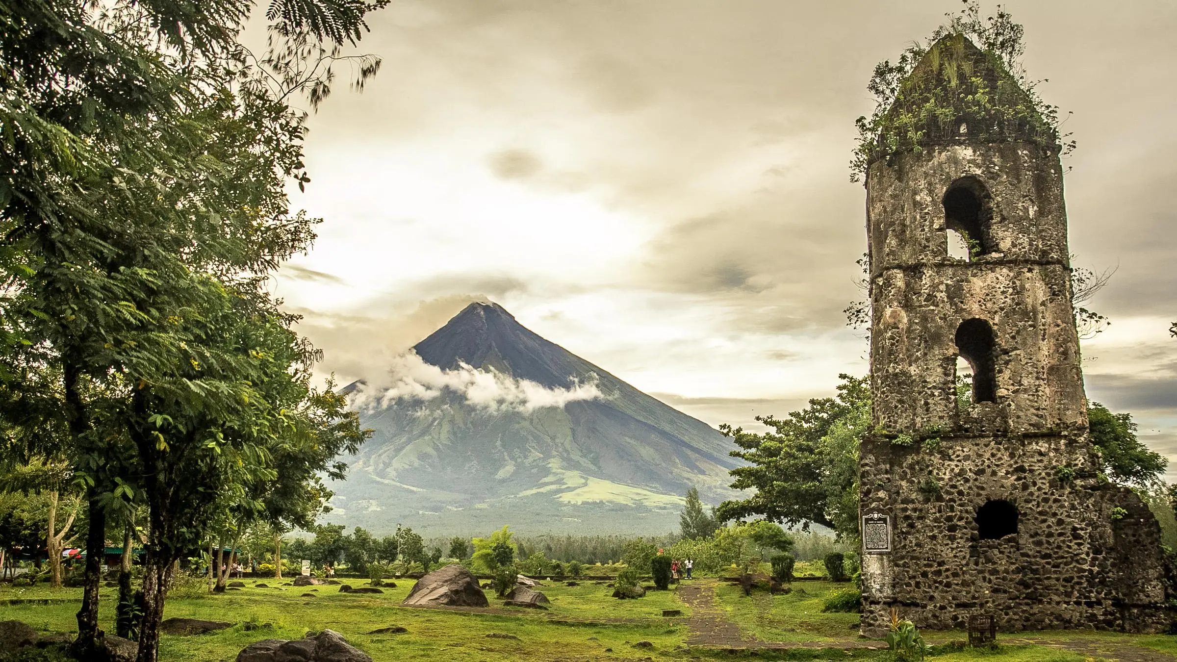
Mayon Volcano stands prominently in Albay province, in the Bicol Region of the Philippines. Known for its remarkably symmetrical cone, it is one of the country’s most recognizable natural landmarks. Communities surrounding the volcano include Legazpi City, Daraga, Camalig, and Guinobatan.
For generations, people have built homes, cultivated farmland, and developed local livelihoods around Mayon. Deposits from past volcanic activity have enriched agricultural soils and provided materials for local construction. The surrounding landscape also supports tourism and has become an important part of local identity.
However, Mayon’s history includes destructive eruptions. One of the most devastating occurred in 1814, when volcanic deposits buried parts of Cagsawa and destroyed settlements, causing substantial loss of life. The remains of the Cagsawa Church still stand as a reminder of that event.
Local authorities and residents reduce volcanic risks through hazard monitoring, planned evacuations, relocation from high-risk areas, and emergency preparedness. The Mayon Volcano Cultural Landscape, included on UNESCO’s Tentative List, documents how volcanic activity has shaped the area’s history, architecture, economy, and settlement patterns.
Mayon demonstrates how a volcano can become central to a community’s identity while remaining a serious natural hazard.
2. Taal Volcano, Philippines
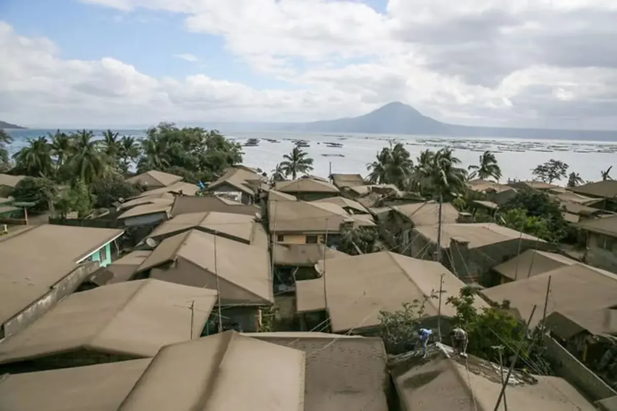
Taal Volcano sits on an island in Taal Lake, in Batangas province, south of Manila. Its location creates a distinctive landscape of water, volcanic landforms, and communities spread around the lake.
Towns such as Talisay, Laurel, Agoncillo, and San Nicolas have developed around the lake. Fishing, agriculture, and tourism have long contributed to local livelihoods. The surrounding scenery has also made the area a popular destination for visitors.
However, Taal is not simply a scenic lake with a volcano at its center. It is an active volcanic system capable of producing dangerous explosions, ashfall, volcanic gases, and base surges. Its January 2020 eruption forced large-scale evacuations and disrupted communities across Batangas and nearby provinces.
The danger is not limited to the volcanic island itself. Certain eruption scenarios can affect lakeshore communities through volcanic hazards, including base surges and volcanic tsunamis. PHIVOLCS therefore maintains hazard maps and monitoring systems to help authorities and residents understand the risks.
Taal illustrates why people must consider the wider volcanic system rather than focus only on the visible crater. Living around the lake requires awareness of hazards that can affect areas beyond the volcano island.
3. Mount Merapi, Indonesia
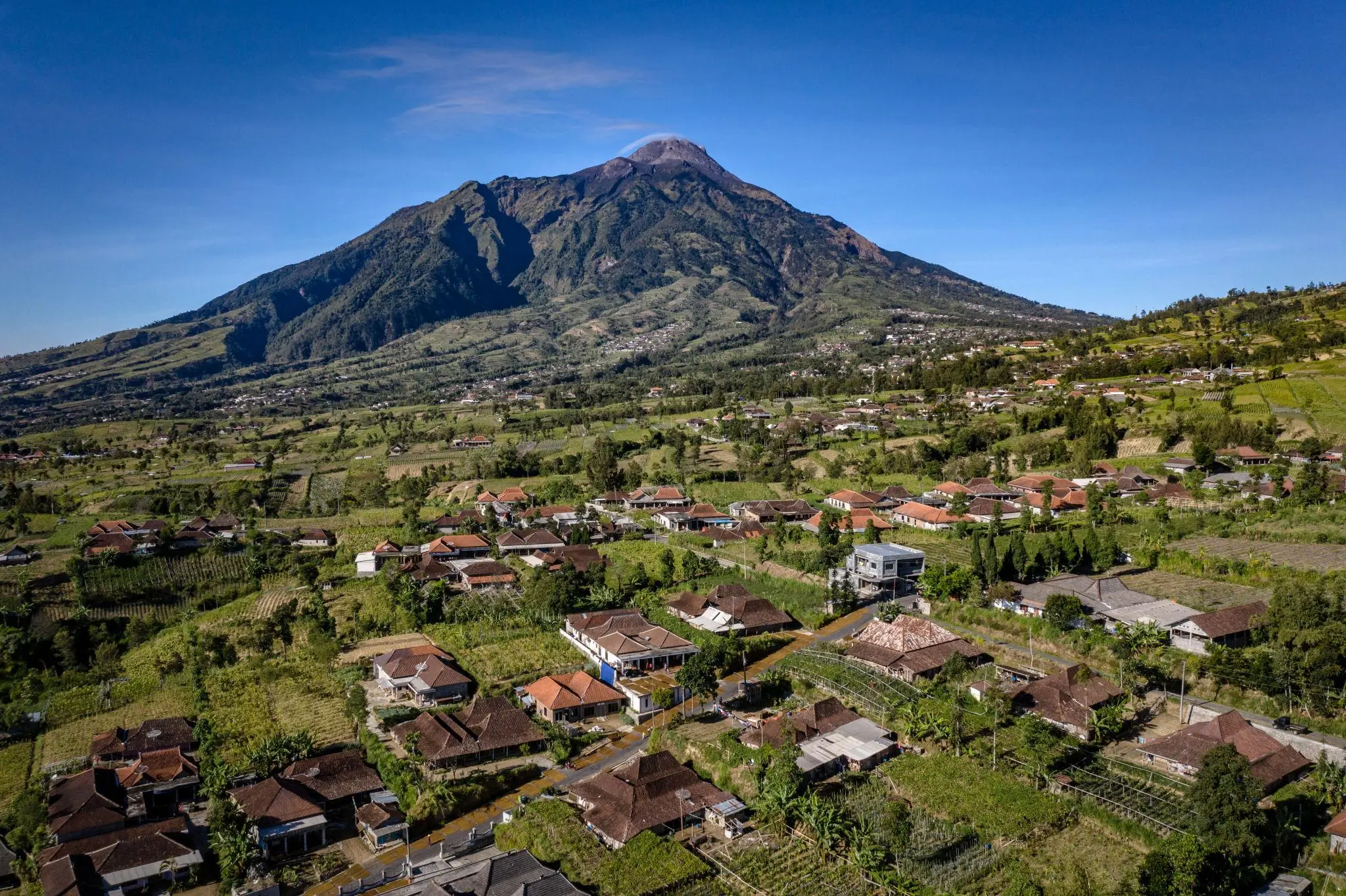
Mount Merapi lies close to major population centers in Central Java and the Special Region of Yogyakarta, making volcanic hazards a significant regional concern. Its fertile surroundings support agriculture, while nearby communities have developed strong cultural and economic connections to the mountain.
Farmers cultivate crops on land enriched by volcanic materials. Villages, roads, and agricultural areas occupy parts of the landscape surrounding Merapi, making the volcano an important feature of everyday life.
Merapi is nevertheless one of Indonesia’s most active volcanoes. Its eruptions can produce pyroclastic flows, which are fast-moving mixtures of hot gas, ash, and volcanic rock. These flows can travel down the volcano’s slopes and pose an extreme danger to settlements in their paths.
The 2010 eruption caused widespread destruction and forced many residents to evacuate. Since then, monitoring, hazard mapping, evacuation planning, and community preparedness have remained essential parts of living in the region.
Merapi shows that fertile land and established livelihoods can keep communities connected to volcanic landscapes, even when the hazards require constant attention.
4. Mount Bromo, Indonesia
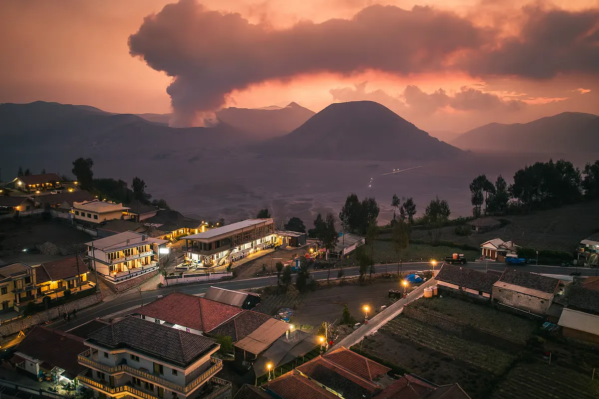
Mount Bromo is part of the Tengger volcanic complex in East Java. Its broad volcanic landscape, surrounding sea of sand, and dramatic mountain scenery make it one of Indonesia’s best-known natural attractions.
The surrounding region is home to Tengger communities, whose cultural traditions are closely connected to the mountain environment. Despite the risks of living near an active volcano, nearby communities continue to depend on agriculture, local businesses, and tourism for their livelihoods.
The Tengger community maintains its spiritual connection to Mount Bromo through the annual Yadnya Kasada ceremony, during which members make traditional offerings. The practice illustrates how religious beliefs, the surrounding landscape, and community identity remain closely intertwined.
Bromo remains an active volcano. Its activity can include ash emissions and explosive events, and authorities may restrict access when conditions become dangerous. Tourism operators and residents must follow official warnings and access restrictions.
Mount Bromo illustrates how volcanic regions can support cultural traditions and local economies while remaining exposed to significant geological hazards.
5. Sakurajima, Japan
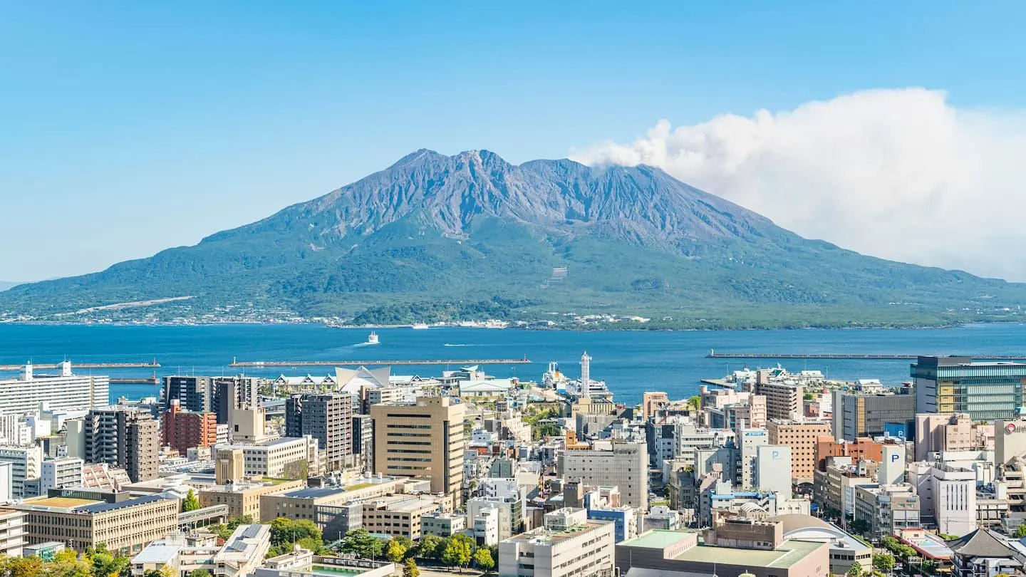
Sakurajima stands in Kagoshima Bay on the southern Japanese island of Kyushu. It is particularly notable because it lies close to Kagoshima City, where a large urban population lives across the water from the volcano.
Sakurajima once stood apart from the mainland as a volcanic island in Kagoshima Bay. During the major 1914 eruption, extensive lava flows connected it to the Osumi Peninsula, changing the surrounding geography.
Today, residents live with a volcano that frequently releases ash and occasionally produces more significant eruptions. Ashfall can affect roads, buildings, agriculture, and daily activities, depending on wind direction and the scale of volcanic activity.
Japan’s volcano monitoring network helps authorities assess volcanic activity, issue warnings, and reduce risks to communities in affected areas. The Japan Meteorological Agency observes Sakurajima and provides information about volcanic activity, while local authorities use warning levels and restrictions to manage access to hazardous areas.
For residents, volcanic ash is not merely a geological curiosity. It is an environmental condition that can influence transportation, cleaning routines, farming, and public safety.
Sakurajima illustrates how communities near active volcanoes can manage ongoing hazards through monitoring systems, public warnings, and coordinated emergency planning.
6. Kīlauea, Hawaii, United States
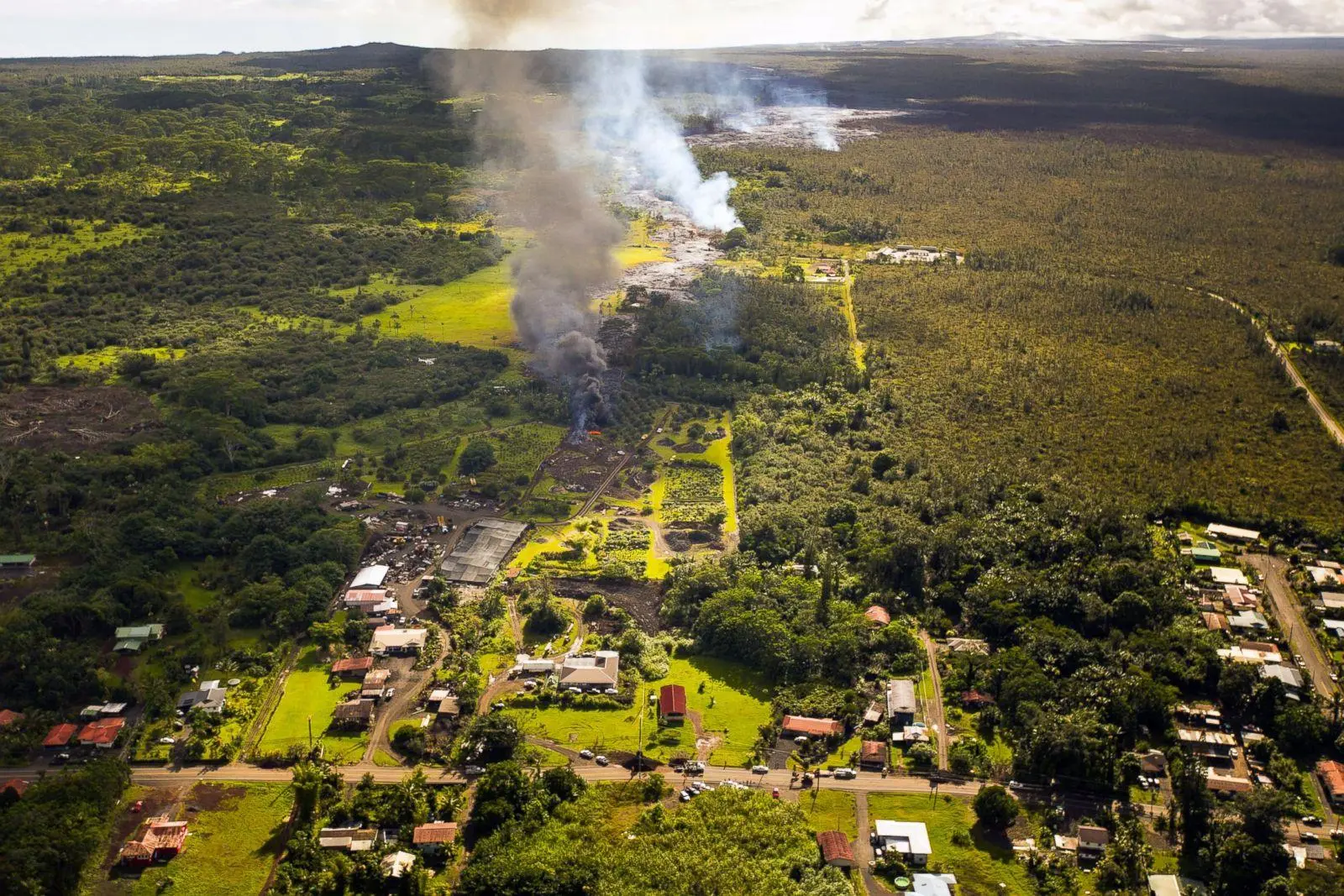
Kīlauea is one of Hawaiʻi’s most active volcanoes. Located on the southeastern part of Hawaii Island, it has influenced the island’s landscape through repeated lava flows and eruptions.
Nearby communities include Pāhoa, Volcano, and Mountain View. Residents live among volcanic terrain where roads, homes, forests, and agricultural areas have developed across landscapes shaped by earlier eruptions.
Kīlauea’s eruptions can produce extensive lava flows that cover land and damage infrastructure. Volcanic gases can also create hazardous air conditions, while earthquakes and ground deformation may accompany changes beneath the volcano.
At the same time, volcanic activity has created landscapes that support distinctive ecosystems and attract visitors. As volcanic materials break down over time, they can help create soil that supports plant growth.
The United States Geological Survey monitors Kīlauea through seismic instruments, ground-deformation measurements, gas observations, and other scientific methods. These systems help scientists detect changes that could indicate rising volcanic activity.
As Kīlauea continues to shape the surrounding landscape, nearby communities rely on volcanic monitoring and hazard information to make informed safety decisions.
7. Mount Etna, Italy
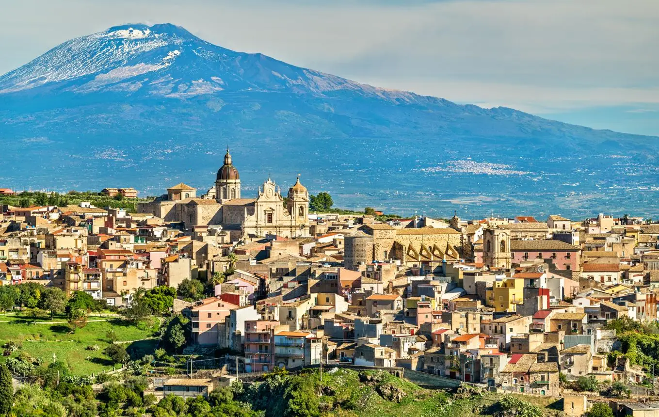
Mount Etna rises above eastern Sicily and dominates the landscape around Catania and several smaller towns. It is among Europe’s most active volcanoes and has erupted many times throughout history.
The volcanic slopes support vineyards, orchards, and other agricultural activities. These varied growing conditions allow agriculture to flourish, with farmers producing grapes, citrus fruits, olives, and other crops across the region.
Towns and villages have also developed along Etna’s lower slopes, where farming, tourism, and local trade support community life. Visitors come to see the volcano’s craters, lava fields, and changing landscapes.
However, Etna’s activity can create serious hazards. Lava flows may threaten roads, buildings, and agricultural land, while ash emissions can disrupt aviation and affect nearby communities. Eruptions can also change access to parts of the mountain.
Authorities monitor Etna and issue information about volcanic activity and access restrictions. Residents and visitors should follow official safety guidance, especially when volcanic activity increases.
Etna illustrates how volcanic landscapes can support productive agriculture and tourism while requiring communities to prepare for recurring geological disturbances.
8. Mount Vesuvius, Italy
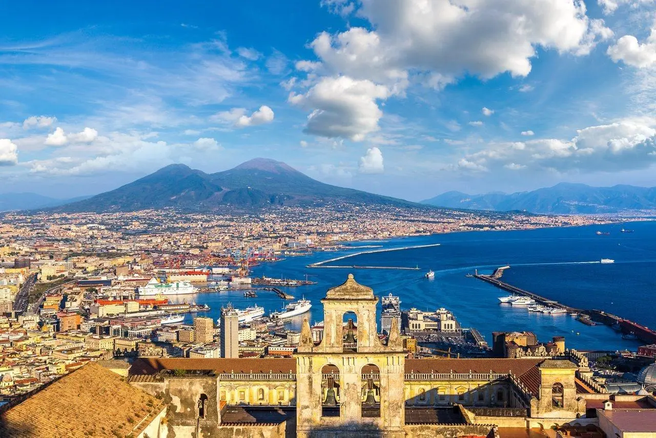
Mount Vesuvius lies near Naples in southern Italy. It is best known for its AD 79 eruption, which buried the Roman towns of Pompeii and Herculaneum beneath volcanic deposits.
Today, towns and densely populated areas surround the volcano. The region’s long history, established infrastructure, employment opportunities, and economic connections help explain why people continue to live near it.
The main concern surrounding Vesuvius is the large population living within its potential hazard zones. A major explosive eruption could produce ashfall, pyroclastic flows, and other dangerous effects across nearby areas.
Italian authorities maintain monitoring and emergency planning for the volcano. Italy has an established evacuation framework for areas at high volcanic risk, but coordinating the movement of large populations presents significant logistical challenges.
The primary hazard around Vesuvius is not simply recurring lava flows but the potential for a powerful explosive eruption.
Vesuvius demonstrates that a prolonged period of relative inactivity does not remove the risk of future eruptions.
9. Popocatépetl, Mexico
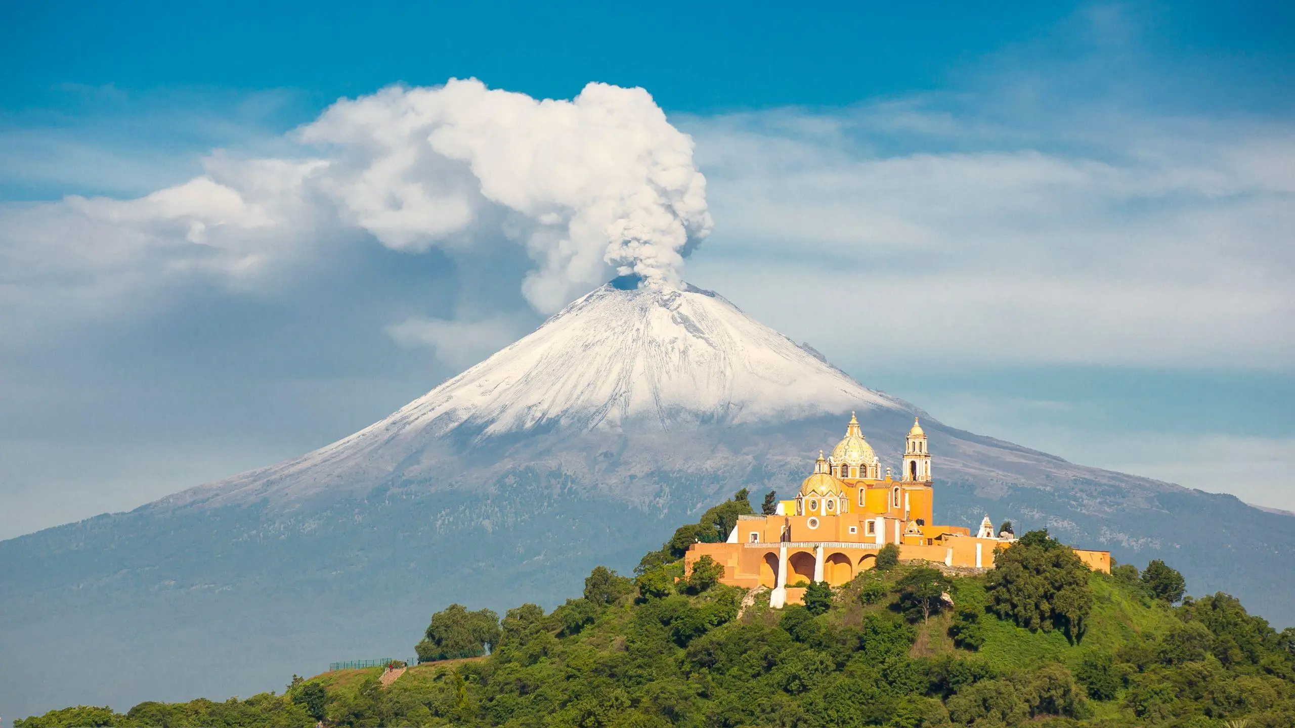
Popocatépetl stands in central Mexico, near the boundaries of Puebla, Morelos, and the State of Mexico. Its name comes from the Nahuatl language and is commonly translated as “Smoking Mountain.”
Towns, farming communities, and densely populated areas surround the volcano. Its fertile slopes support farming, while nearby settlements have developed over generations within the broader volcanic landscape.
Popocatépetl has experienced recurring activity, including ash emissions, gas releases, and explosive events. Strong eruptions can send ash far from the volcano, affecting communities downwind.
CENAPRED, Mexico’s National Center for Disaster Prevention, monitors volcanic activity and shares information to help authorities and communities assess potential hazards. Authorities also use hazard maps and restricted-access zones to reduce exposure to dangerous areas.
The volcano’s proximity to large population centers makes monitoring and public communication especially important. Residents must understand that changing wind conditions and volcanic activity can affect communities in different directions.
Popocatépetl shows how volcanic hazards can affect not only rural communities but also large cities and densely populated areas.
10. Pacaya, Guatemala
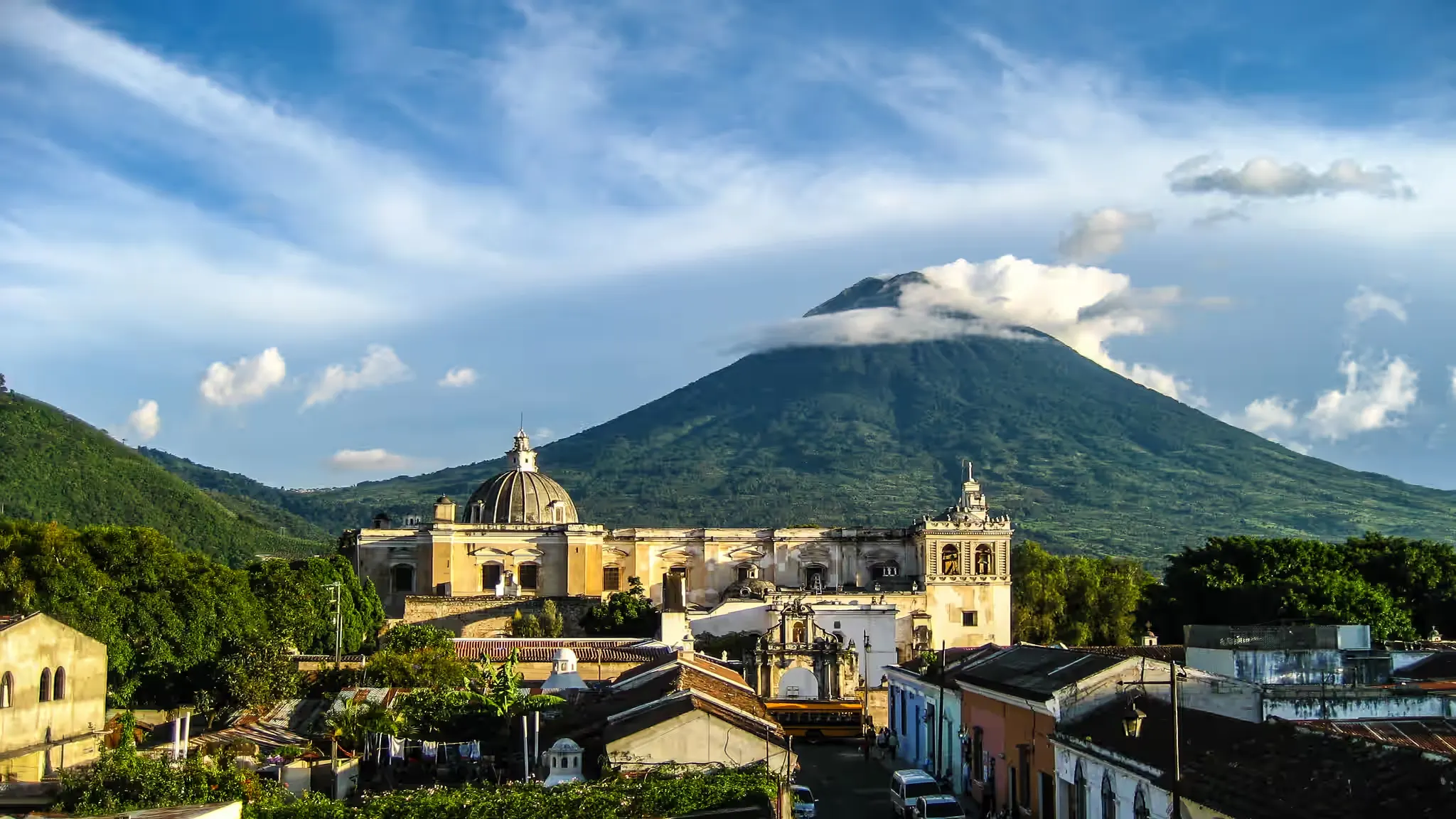
Pacaya is one of Guatemala’s most well-known active volcanoes. South of Guatemala City, the volcano stands within a region where agricultural communities and residential settlements have developed around its volcanic terrain.
The surrounding area supports farming and tourism. Visitors come to Pacaya to see its volcanic landscape, enjoy the views, and sometimes observe volcanic activity.
However, the volcano’s eruptions can produce lava flows, ash emissions, and falling volcanic fragments. These hazards can affect nearby communities, farmland, roads, and tourism activities.
Guatemala relies on national volcanology and disaster-monitoring agencies to assess volcanic activity and provide information that helps local authorities manage potential risks. Access to certain areas may be restricted when conditions become hazardous.
Pacaya highlights the complicated relationship between volcanic tourism and public safety. Although the volcanic landscape attracts tourists, nearby communities continue to face the challenges of living and earning a livelihood in an area exposed to volcanic hazards.
What Living Near Active Volcanoes Teaches Us
The communities around these ten volcanoes show that people do not always leave landscapes exposed to natural hazards. Many remain because of family connections, established homes, agricultural opportunities, employment, cultural traditions, and economic needs.
Volcanic soil can support farming, while geothermal resources and tourism can contribute to local economies. In some places, volcanoes also shape architecture, religious practices, and regional identity.
However, these benefits do not cancel out the dangers. Volcanic eruptions can destroy homes, damage livelihoods, displace communities, and put lives at risk. Some hazards can travel beyond the immediate slopes, affecting towns and infrastructure many kilometers away.
The most important lesson is that living near an active volcano requires more than familiarity with the landscape. It requires reliable monitoring, accurate hazard maps, clear evacuation plans, public education, and the willingness to follow official warnings.
The relationship between people and volcanoes is not simply one of survival. It is also shaped by history, culture, economic opportunity, and the decisions communities make about where and how to live.
For another look at how unusual landscapes and geological features shape the world around us, see 10 Natural Wonders That Are Almost Too Strange to Believe. And for a closer look at striking structures that challenge conventional design, read 10 Buildings That Look Like They Belong in Another World.
Frequently Asked Questions (FAQs)
A volcano is generally considered active if it has erupted within the last 11,700 years or still shows signs of volcanic activity. Definitions can vary among scientific organizations.
Awareness of volcanic hazards does not necessarily mean residents have the resources or opportunity to relocate. Family history, employment, farming, tourism, and strong community ties can make relocation difficult. These reasons do not mean that the area is free from danger.
Many volcanic soils can be fertile because weathered volcanic materials supply minerals that support plant growth. However, soil quality varies, and newly deposited volcanic material may initially be unsuitable for cultivation.
The hazards depend on the volcano and its eruption style. They can include lava flows, pyroclastic flows, ashfall, lahars, volcanic gases, earthquakes, and landslides. Some hazards can affect communities far from the summit.
Some volcanic areas have designated visitor routes and managed access. However, conditions can change quickly. Visitors should follow official warnings, respect exclusion zones, and never enter restricted areas.
Scientists use seismometers, satellite observations, ground-deformation measurements, gas monitoring, thermal cameras, and visual observations. These methods help identify changes that may indicate rising volcanic activity.
Countries such as Indonesia, the Philippines, Japan, Italy, and Mexico have substantial populations living near volcanic systems. People face different levels of danger depending on how close they live to the volcano and which hazards could reach them.
References
The following authoritative organizations provide scientific information, historical records, volcanic monitoring updates, and hazard assessments related to the places featured in this article.
- UNESCO – Mayon Volcano Cultural Landscape – Information about Mayon’s cultural significance, historical landscape, and relationship with surrounding communities.
- PHIVOLCS – Philippine Institute of Volcanology and Seismology – Official information about Mayon and Taal volcanoes, including volcanic activity, hazard assessments, and public safety guidance.
- United States Geological Survey – Hawaiian Volcano Observatory – Scientific information about Kīlauea, volcanic eruptions, lava flows, and monitoring activities in Hawaii.
- Italy’s National Institute of Geophysics and Volcanology (INGV) – Scientific research and volcanic monitoring information about Mount Etna and other Italian volcanoes.
- Italian Civil Protection Department – Information about volcanic hazards, emergency planning, and preparedness around Mount Vesuvius.
- CENAPRED – Mexico’s National Center for Disaster Prevention – Official information about Popocatépetl, volcanic monitoring, alert levels, and hazard prevention.
- INSIVUMEH – Guatemala’s National Institute of Seismology, Volcanology, Meteorology and Hydrology – Volcanic monitoring information and scientific observations concerning Pacaya and other Guatemalan volcanoes.
- Smithsonian Institution – Global Volcanism Program – Scientific records, volcano profiles, eruption histories, and information about active volcanoes worldwide.